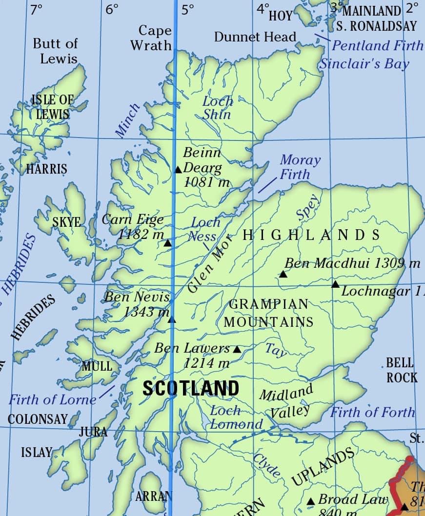
By accident, I came across a website by Bill Jack called the 5 Degree Challenge. Here a route is described following the 5 Degree West Line of Longitude from the southern tip of the Cowal Peninsula to Cape Wrath. The route promises to traverse the finest walking terrain in Scotland as well as being one of the most challenging long hikes in Britain. This all sounded fantastic and I was also pleased it was a lengthwise coast-to-coast hike across Scotland, something I’d not done before.
 |
| 5 Deg west |
Bill has an excellent route description on his website and before long I had his route plotted on my maps. Bill is the first to admit that it would be possible to keep closer to the 5 deg line than his route did but I think he did a good job of keeping close enough to the line while remaining hikeable.
Bill set some basic rules which were –
“deviation from the five-degree line has to be minimised and the line must be contacted at least once every day of the walk”
Sounded fair to me. To hike the 5 deg line precisely is near impossible and there would always be a need for some deviation. In places that deviation will be considerable as the line crosses a number of big Lochs, while in other areas it plummets over cliffs.
Starting with Bill’s route I “improved” it a little. Particularly in the first section, it is possible to get much closer to the 5 deg line if you are prepared to make your own way through the many commercial forestry plantations. However, in some sections, I chose to deviate further away, either because I knew of a better (easier!) way, or for resupply.
My own rules for this hike were –
- Like Bill, the 5 deg line must be crossed at least once/day.
- It must be hikeable in 3 weeks, that was all the time I would have available.
- Deviating from the line for resupply was acceptable as long as rule 1 was honoured.
- Always honour rule 1!
 |
| 5 Deg route |
While this hike passes through some remote country resupply was relatively simple. There is a train service from the nearby villages of Dalmally and Achnasheen which will get you to large towns/cities with supermarkets. The route also passes close enough to Fort William to deviate that way. Fort William is also a good place to pick up any replacement kit with many good outdoor shops. Food drops, or hitching into towns, would be a possibility but not something I felt necessary.
My resupply strategy was –
- Cowal Peninsula – Dalmally 98km (train to Oban)
- Dalmally – Fort William 86km (resupply Fort William)
- Fort William – Achnasheen 142km (train to Dingwall)
- Achnasheen to Cape Wrath 170km
The route
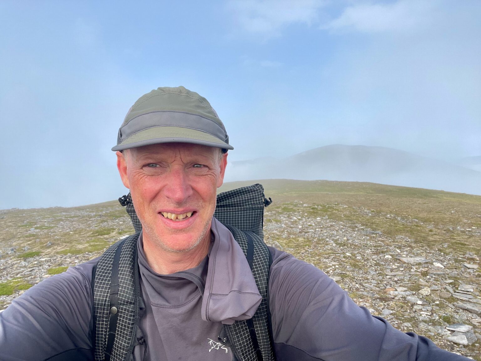
This is a tough hike and only recommend to those who are happy carrying heavy loads over rough and trackless terrain. Being able to read the terrain and pick the best way across steep, rough and trackless ground, in all weathers, is a necessary skill. While this is a route that rewards those that travel light you will still carry 5-7 days of food and other gear up and down some very steep and relentless terrain.

Section 1 - Cowel Peninsula to Dalmally, 98.5km (3 days)
This is by far the easiest section and a great way to ease yourself into the hike. Mostly, you can link together existing paths/tracks but there are still large areas of cross-country hiking involved. The Cowal Peninsula is heavily planted with commercial forests and a good portion of this section is spent passing through them. This is the main area where I thought Bill’s route could be improved and I kept a lot closer to the 5 Deg Line than he did. I did wonder why he deviated so far but I soon found out.. access, or rather lack of it! Many of these commercial forests were being harvested and access when harvesting is severely restricted. In other areas, I found many locked farm gates surrounded by high deer fences, with no method of easy access for walkers. This area clearly isn’t hiked often and I didn’t see a another hiker. Fortunately, luck was on my side in that I chose to start my hike Friday and normally there is no harvesting over the weekend. My big tip for future hikers is to do the same, start hiking midday Friday and push through to Dalmally by midday Monday and you SHOULD be fine. I ignored all the “stop, no not enter signs” and climbed all the locked fences/gates, and had no issues.


This was a tough section for a number of reasons and I didn’t always follow my planned route. My first issue was a case of suspected food poisoning! In Oban I got a ready-cooked roast chicken and that night I felt terrible! Being sick in the hills is never fun but especially when I knew this was going to be such a tough section, even if fully fit. The effects of that poisoning continued all the way to Fort William but it did at least ease for the final day. Also, it got hot, really hot, but also very humid. Unusually for Scotland daytime temperatures touched 30C but add in the humidity of 70-80% and it felt a lot hotter. At times I simply couldn’t keep hydrated and I had to try and limit the amount of ascent, and time the big climbs for early morning, not easy on this hike! There are a lot of popular Munro’s in the area so, at times, you will hike on good paths but there is also a lot of challenging cross-country hiking to be done.
Day 1, feeling ill I pushed on with the planned route but the pathless terrain to Bealachan Lochain Ghaineamhaich took its toll. After summiting Glas Bheinn Mhor I headed down to Glen Coe to find somewhere to camp, absolutely exhausted. That camp, squashed between two blowdown trees, in a commercial forest, was a low point of the trip. I still felt terrible, it was unbearably hot, I’d gotten behind schedule and I wasn’t sure if I could even carry on. By morning I was feeling a little better, not good enough to continue the planned route, but at least good enough to keep hiking. Instead of taking the high route over Stob Coire Sgreamhach, Am Bodacgh and Meall Dearg, I joined the West Highland Way at the Devil’s Staircase and followed that into Kinlochleven. That plod along the WHW was exactly what I needed and quite possibly saved the hike. I camped early that day, in some pre-cleared camping spots just past Kinlochmore.
With COVID-induced staycations being a thing this year accommodation was extremely scarce. I’d had to prebook a room in Fort William which meant I needed to be in town the following day. Though I was feeling a lot better I still had the Mamores and Nevis Range to cross which wasn’t going to be possible given the time, my fitness, and this heat. I decided to cross the Mamores, as planned, then head straight down Glen Nevis into town. Sadly Ben Nevis would have to be dropped. It was a tough decision given that the summit is so close to the 5 deg line.


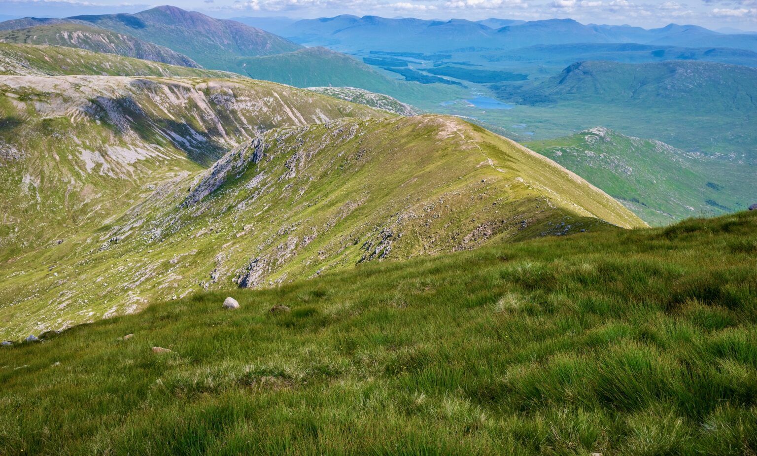


Section 3, Fort William to Achnasheen, 142km (4.5 days)
While the walk back to the 5 Deg Line, up the Great Glen, starts easy enough you are soon into a rollercoaster of a section. There are a number of Glens, running west-east, and most are surrounded by high mountains. The route passes across these Glens and that means a lot of ascents followed by descent, and repeated, time after time! You are walking against the flow of the Glens and there are large sections of cross-country hiking to be done. It was very challenging but a section I really enjoyed. The hot and humid weather continued but at least I was feeling well again.
It was in this section that one of the most bizarre moments of my life happened. After a fantastic day's hike from Glen Affric to Glen Strathfarrar I set up camp near Loch Monar.


2 minutes of fame, the midge incident!
It was a hot but breezy evening, too hot to get into the tent until the sun dropped below the horizon. Soon after entering I dropped off to sleep but was suddenly woken by what sounded like rain. Having left the flysheet door open I was about to open the inner, and close it, when I could see it couldn’t be raining, the sky was cloudless. It was cloudless except it was oddly dark and that patchy darkness was moving in random patterns. It took a few moments to register that it was midges, and in huge clouds, clouds of midges larger than I’d ever seen. After watching for a while, safe in my sealed inner tent, I dropped off again praying that the wind would pick up and clear them away. Unfortunately, I woke to a clear and calm morning, though the sky was still grey with midges! Normally I’m ok with midges, they do bite me, and they can be annoying, but when bitten they normally wear off after an hour or two. However, looking out there from my sealed cocoon horrified me. Midges are persistent, and even with a head net and repellent, it wasn’t going to be a pleasant experience. Skipping breakfast I packed up as quickly as possible and took a short video clip that I would later post on Twitter. The reaction to that post was insane and it was soon picked up by the likes of the BBC and a number of local and national newspapers. Even radio got involved and the theme of a BBC Radio 2 program was my midge clip, with the listeners having to pick suitable songs to go with it!


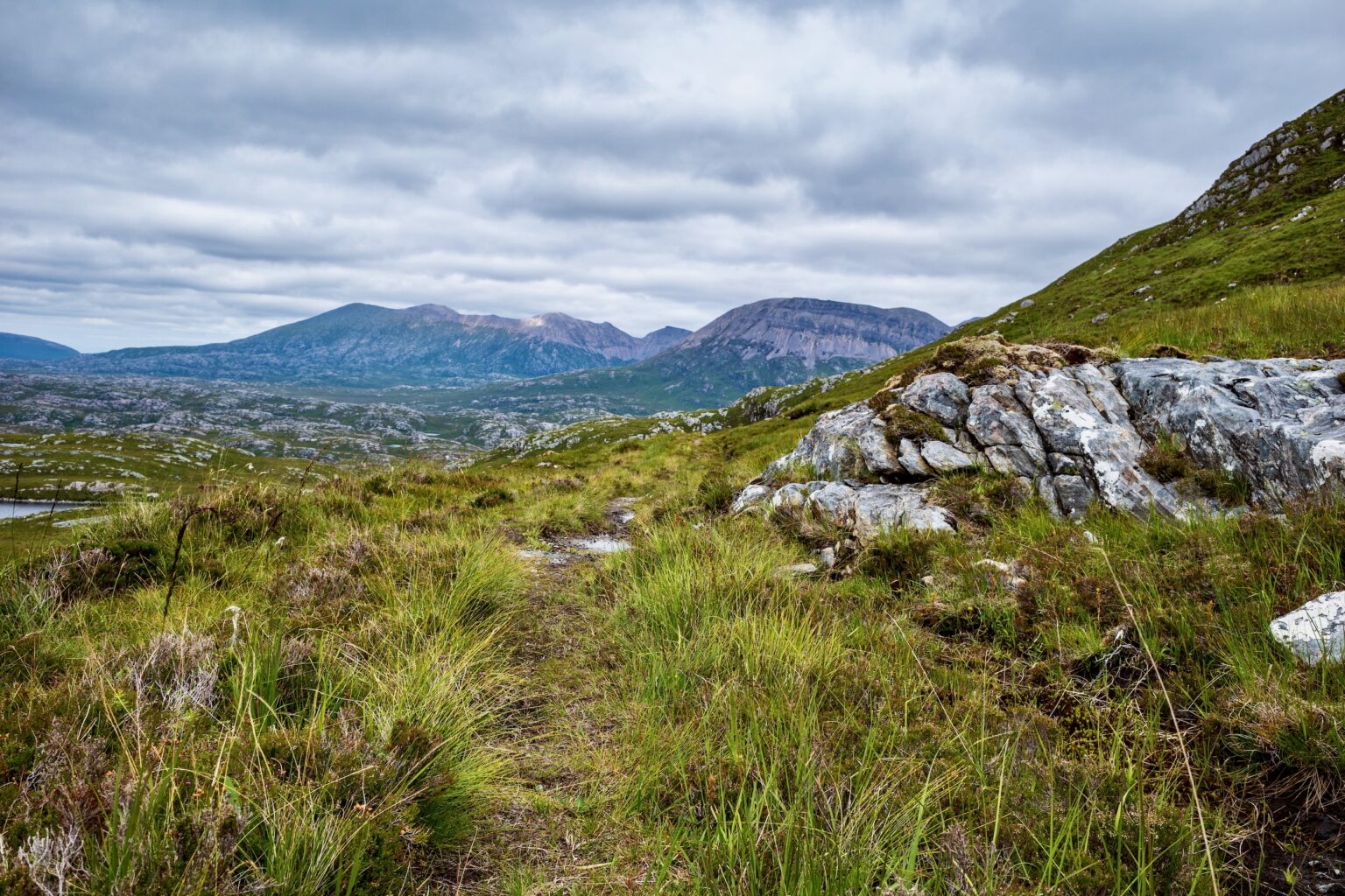
Section 4, Achnasheen to Cape Wrath, 170km (5.5 days)
For now, the hot weather had passed, and for most of this section I had more typical Scottish weather, though strangely still little rain. I was happy it was much cooler. This is the only section where there is any significant road walking and while I had remembered these roads as being quiet, that had all changed with the popularity of the North Coast 500 route. There is now a lot of fast traffic, on very narrow roads, and it wasn’t much fun walking them. Once away from the roads the walking here was really special and I’m now a huge fan of the far north of Scotland. Here, there are fewer Munro’s and therefore fewer walkers, paths and tracks. It still feels wild, unspoilt and remote, it reminded me of Nordkapp, in Northern Norway. For the final day’s walk into Cape Wrath, the clouds cleared and the sun shone which seemed a fitting end to what was a spectacular hike.